Googled out of existence
So, friends call to invite you for a paddle along the Humbug Reach of the Brisbane River. Or ask you to meet them for a coffee at Hill End. You grab your smart phone, go to the maps app and punch in the place name. Destination unknown!
For decades, old fashioned street directories managed to identify everything of importance in our city. Now, thanks to globalisation and the tech giants, important bits of our geography and history are vanishing from view. Googled out of existence! . (more)
Humbug to globalisation!
I’m sure there are lots of reasons why globalisation is good. A broader outlook for an interconnected world and all that. But there’s something that really troubles us about our ever more homogenised existence. We are losing the detail, the fine grain that gives us our unique, local character.
Sure we can roam the world more efficiently and cost-effectively. But is it as interesting? Should integration and interconnection come at the cost of individuality? No. Heritage and local identity are not expendable.
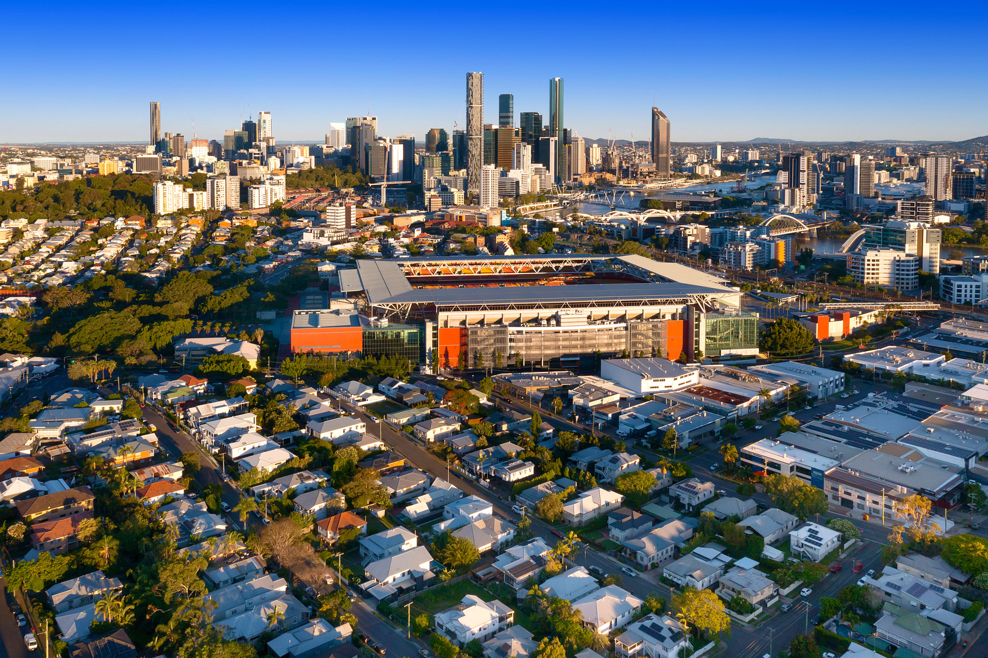
You’ll often hear this agency refer to prime stretches of the Brisbane River by their ‘reach’ names. Now we find newcomers, and younger generations only ever reliant on digital maps, have no idea what we mean.
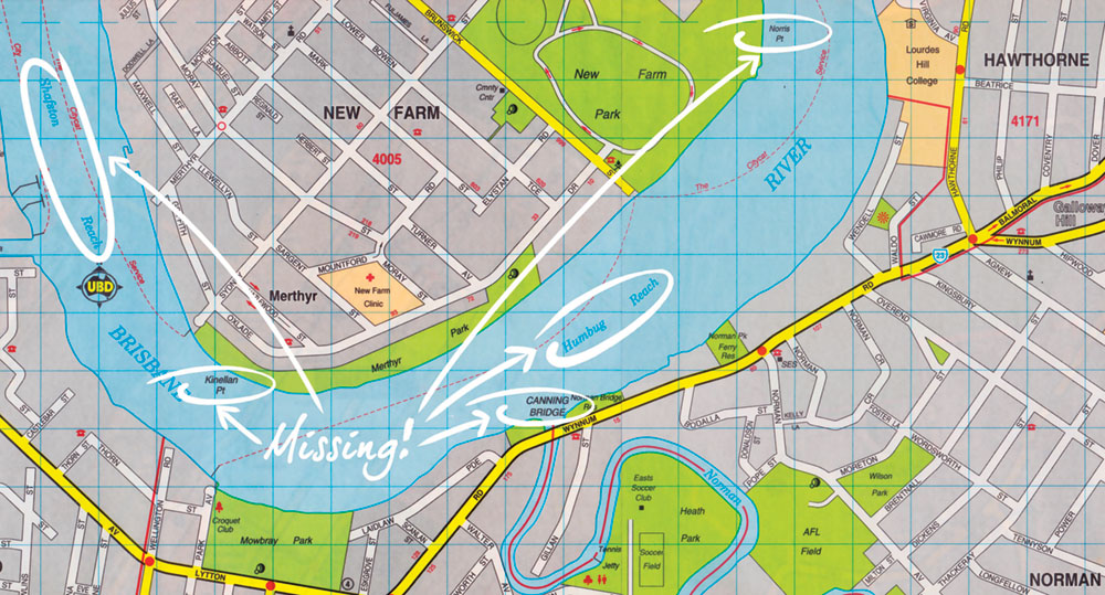
On close inspection of the map apps, we discover the names of geographic features, landmarks, waterways, and even whole suburbs have disappeared. A UBD vs Google / Apple Maps comparison on the Brisbane River highlights serious omissions by the computer cartographers.
Starting at the Quarantine Flats Reach (which we should point out is near the river mouth, because you won’t locate it on either map app), we travel upstream to find so much history expunged.
This reach recalls the heritage-listed Commonwealth Quarantine Station at Lytton, to which any ships carrying sick passengers (signalled by a yellow flag as they passed the Pile Light) would have to transfer their voyagers for a period of isolation.
Beyond the self-explanatory Lytton Reach is Quarries Reach at Eagle Farm-Murarrie, an important resource for early Brisbane. In fact, it supplied sandstone for our oldest stone residence, Bulimba House, built in 1849-50 by Andrew Petrie for early pastoralist David McConnel and his wife Mary.
Missing are Hamilton and Bulimba Reaches and the evocatively named Humbug Reach, a polite expression of the frustration experienced by settler sailors encountering its difficult winds and currents.
So too Shafston Reach, christened for the grand 1850s residence on its bank at Kangaroo Point, Town or Gardens Reach and South Brisbane Reach. And don’t even bother asking Google Maps to locate Petrie Bight. “Make sure your search is spelled correctly,” it chides.
All the reaches named for famed inner suburbs Milton, Toowong and St Lucia don’t exist on these modern-day directories. So it’s pointless expecting to find Cemetery Reach at Dutton Park or Long Pocket Reach at Indooroopilly / Fairfield-Yeronga.
And speaking of Long Pocket, we now realise whole suburb localities have been wiped off the map. No Hill End, at least not in Queensland. No Ironside near St Lucia. There’s a Long Pocket in North Queensland, but nowhere near Indooroopilly.
Indooroopilly has also lost one of its most historic place names, Canoe Reach, a name that arose from European contact actually pre-dating John Oxley’s settlement at Redcliffe.
In April 1923, Thomas Pamphlett and two others were shipwrecked on Moreton Island. They made it to the mainland and walked upstream along the Brisbane River as far as Oxley Creek where they found two native canoes. They used one to return to the coast, and were found by explorer Lieutenant John Oxley in October at Bribie Island.
Beyond the now invisible Indooroopilly and Chelmer reaches, we should (but don’t) finally find Mermaid Reach, named by Oxley when he explored this fine stretch, charted the Seventeen Mile Rocks and climbed Mt Ommaney. It’s named for his boat, the Mermaid.
Our map study on the river also revealed dozens of land features once identified in the UBD have been discarded. Norris Point at New Farm Park, Kinellan Point (for a grand Merthyr home of a former premier), even Gardens Point and Kurilpa Point go unidentified.
We can’t find Kayes Rocks at Toowong, Ovens’ Head at Dutton Park (named for one of Sir Thomas Brisbane’s staff), or The Elbow, which marks the river bend at UQ campus. Carrington Rocks too (the outcrop, not the boating club), are unidentified.
Even more surprising, the Seventeen Mile Rocks are missing. This notable submerged ridge, now largely removed but for which a whole suburb is named, marks a distance of 17 miles (27km) from the river mouth.
Important bridges also go unidentified on one or both of the map apps – the heritage-listed Canning Bridge over Norman Creek, the Merivale Bridge, Pamphlett Bridge over Oxley Creek between Tennyson and Graceville and, incredibly, the Walter Taylor Bridge.
So, if you’re looking for a reach of the Brisbane River, or many other features, your best bet might be to reach for the old UBD!